
Since its launch in 2023, CTrees’ Land Use Change Alerts (LUCA) platform has redefined what’s possible in the realm of global forest monitoring. The radar-based system goes well beyond the capabilities of traditional platforms, detecting disturbances in near-real-time and at a high-resolution across tropical, temperate, and boreal forests alike.
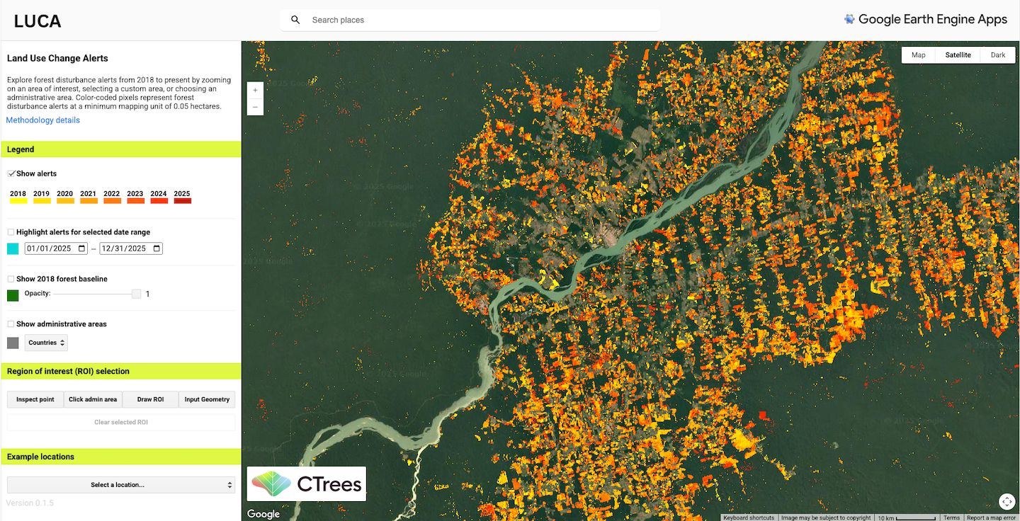
LUCA provides open access to biweekly global forest disturbance alerts from 2018 to present.
Available via a free Google Earth Engine app, LUCA offers users the ability to explore alerts and download historical statistics for any administrative area or custom boundary.
At the center of this powerful tool is CTrees scientist Adugna Mullissa, Ph.D. With an extensive background in remote sensing science, Mullissa has spent the last 13 years working with radar and machine learning methodologies—culminating in LUCA’s cutting-edge capabilities.
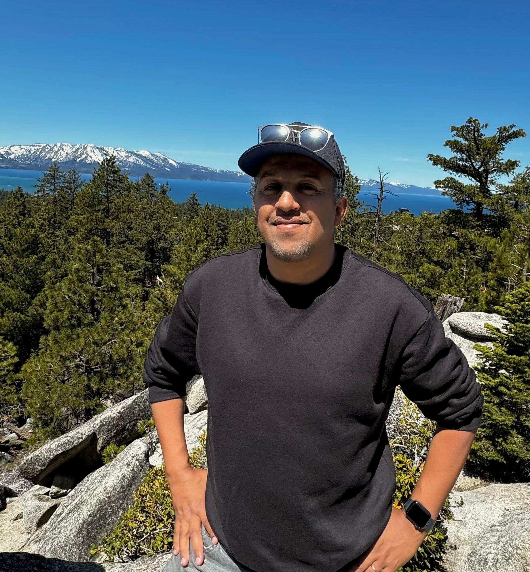
The CTrees scientist leading development of LUCA, Adugna Mullissa.
With the upcoming launch of NISAR and several major updates planned for LUCA, including efforts to make the underlying data more accessible, CTrees communications manager Rachel Kovinsky sat down with Mullissa to discuss the development of the open data tool, and look ahead to its future. Read their conversation below:
What motivated the development of LUCA?
Historically, most forest change monitoring systems have relied on optical satellite imagery. These systems have certainly been valuable, but they come with limitations. Cloud cover, smoke, and atmospheric interference can all obscure images, especially in tropical regions like the Amazon and Congo Basin where deforestation is most intense.
Many existing systems are also focused on detecting large-scale disturbance and often overlook the smaller but still significant changes, like selective logging and smallholder clearing.
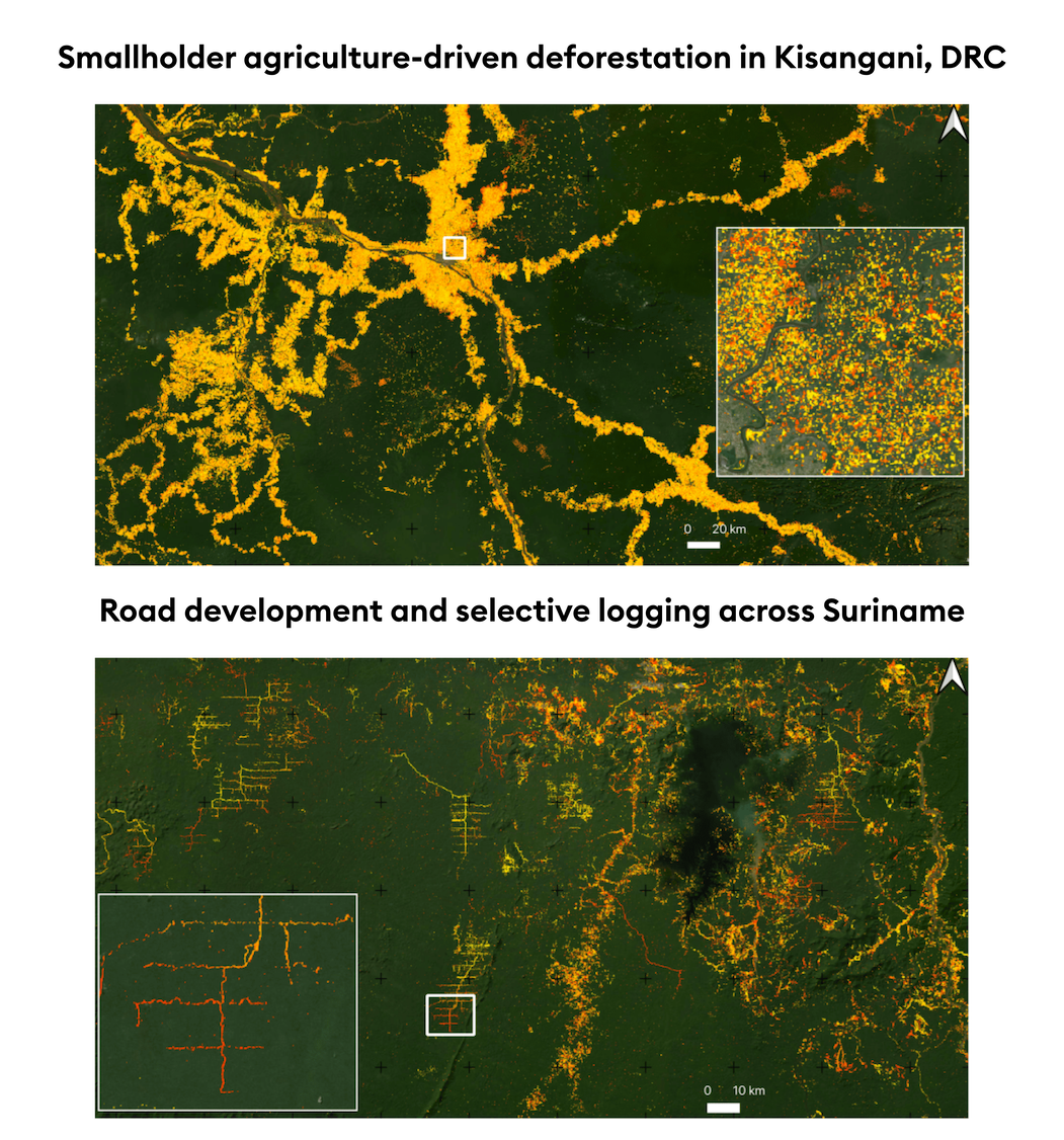
When we started working on LUCA, we wanted to build something that could close the temporal and spatial gaps in existing monitoring systems—particularly in the places where forests are most at risk.
LUCA was developed with the ultimate goal of tracking forest land use change using synthetic aperture radar (SAR) data. As a first step, we focused on mapping forest disturbances—such as deforestation, logging, fire, and clearing—because these are often the earliest indicators of greater land use shifts. Disturbance mapping serves as the foundation for understanding more complex patterns of land conversion, degradation, and reforestation over time.
Broadly, LUCA was created to be a platform that offers near-real-time, high-resolution detection of forest land use changes, big and small, on a global scale. Our intention was always to build a monitoring system for public good that can help governments, NGOs, and researchers monitor and respond to forest changes quickly and effectively.
What are some of LUCA’s unique features and capabilities?
Forest disturbance alert platforms are typically designed with the common goal of detecting disturbances like deforestation and degradation, but what really sets LUCA apart is how granular, accurate, and far-reaching its monitoring capabilities are.
Most alert systems rely heavily on optical satellite imagery—which, as I mentioned, are great until clouds get in the way. In contrast, radar can penetrate cloud cover and doesn’t depend on sunlight.
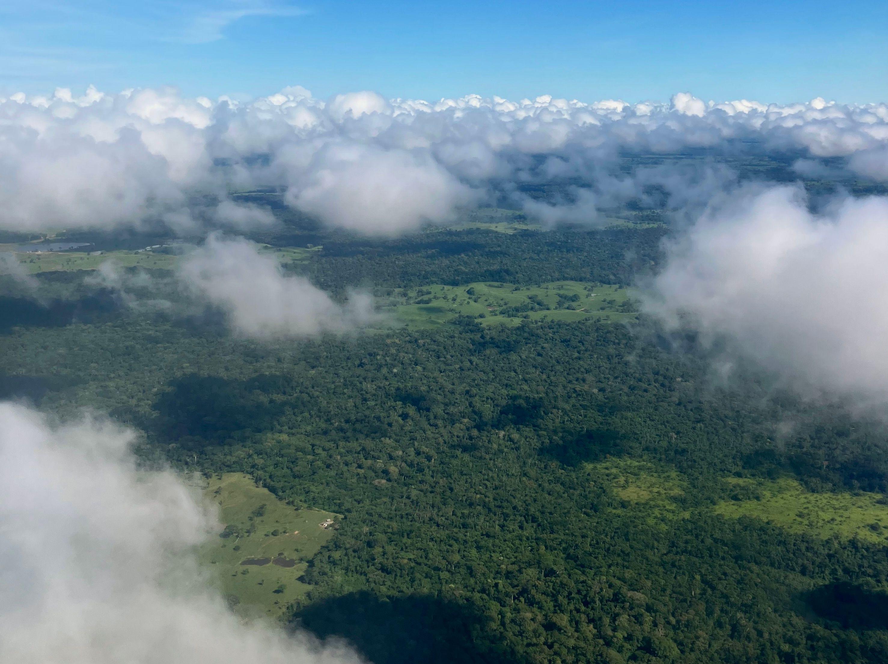
An example of cloud cover over the Amazon forest in the state of Acre, Brazil (Photo credit: Daniel Melling).
LUCA is the only near-real-time global alert system based on synthetic aperture radar (SAR), meaning that it can monitor forest change regardless of weather or time of day. Other radar-based systems exist, but they are geographically limited to the humid tropics.
Another major strength of LUCA is its spatial resolution. The platform detects changes at a minimum mapping unit of 0.05 hectares (roughly equivalent to the size of two standard tennis courts), which is finer than what other alert systems can offer. This allows LUCA to pick up on subtle and small-scale changes that may otherwise go unnoticed in coarser-resolution systems—activities like selective logging, smallholder-driven encroachment, or even degradation from fires or illegal road construction.

Accuracy is also a major priority. Rapid updates are important, but only if they are reliable. LUCA combines advanced radar preprocessing, machine learning, and time-series analysis to reduce false alarms. LUCA’s reliance on radar also helps avoid many of the typical misclassifications that plague optical systems—like mistaking cloud shadows or dry-season changes for deforestation.
And then there is scale. While many alert systems are limited to specific regions or forest types, LUCA is global. It can monitor expansive tropical regions including the Amazon, as well as temperate and boreal forests in places like the United States, Canada, and Europe. It is also scalable and can be tailored for more local-level applications.
Finally, LUCA is fast—faster than most other systems currently out there. Many platforms only update monthly, but LUCA provides biweekly alerts. And with new satellites coming online soon, LUCA will provide even faster updates, on a near-weekly basis. This frequency will make a real difference, allowing authorities to act quickly and respond to forest threats in real time.
What are potential applications and opportunities for real-world impact with LUCA?
We built LUCA to enable faster responses to illegal deforestation and degradation. LUCA is good at capturing dramatic forest losses, but it is also highly effective at detecting smaller, slower-moving types of forest degradation that can add up over time.
The frequency of the platform’s alerts mean that decision-makers—from government agencies to local NGOs—can intervene quickly. This is crucial for preventing further damages in places like protected areas and Indigenous territories, where even small-scale disturbances can have serious long-term consequences.
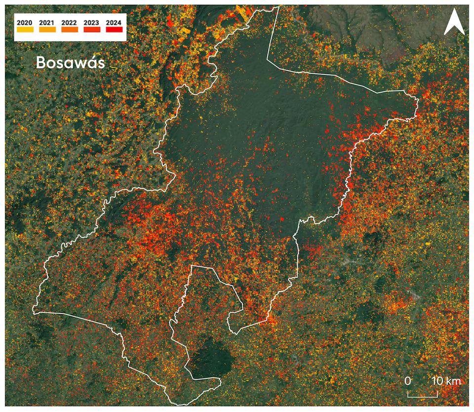
LUCA highlights disturbances in Nicaragua's protected Bosawás reserve from 2020-2024.
LUCA can also play a key role in mitigating climate change, particularly through REDD+ and other carbon finance initiatives. These programs have long faced challenges to ensuring that emissions reductions are based on accurate and verifiable data. But with LUCA, stakeholders and investors can use the platform to identify deforestation events as they happen. These timely and transparent insights can support the integrity of climate finance mechanisms on a global scale.
More generally, I see a lot of opportunities for scaling LUCA’s adoption. Embedding the technology into policy frameworks and operational workflows can shape how decisions are made, resources are allocated, and forest protection is enforced.
LUCA is already being integrated into national forest monitoring systems (e.g. Gabon), near-real-time jurisdictional REDD+ performance tracking systems, law enforcement frameworks, and conservation strategies. There is also growing potential for LUCA to support companies in their efforts to track supply chains and meet zero-deforestation commitments.
These kinds of opportunities for implementation—where science and technology meet accountability—are what I see as the most impactful applications of LUCA.
Looking ahead, what excites you most about the future of LUCA?
When I think about the future of LUCA, there’s a lot to be excited about. I’m energized by how quickly satellite radar technology and AI-driven analytics are advancing—and how these breakthroughs will allow LUCA to become an even more powerful and precise tool.
One of the biggest updates on the horizon is the arrival of new radar satellite data from ESA’s Sentinel-1C and NISAR, a joint mission between NASA and ISRO. These satellites will reduce the time between observations, allowing LUCA to shift from biweekly to weekly alerts. That kind of timeliness will make a real difference, because the faster we can detect changes, the faster authorities can respond.
The launch of NISAR is particularly significant because its L-band radar will enhance our ability to characterize changes in forest structure, improving detection of deforestation and degradation.
We’re also working to improve how LUCA understands and explains forest land use changes. LUCA currently detects forest change, but we want to understand exactly where deforestation, degradation, and forest loss due to management practices is happening. We also want to understand why it’s happening: Is the forest loss in an area driven by agriculture? Infrastructure? Logging?
Through integrating radar data with optical imagery from platforms like Sentinel-2, Landsat, and PlanetScope, we’re working to improve LUCA’s ability to differentiate between the different drivers of forest loss and map forest regrowth. AI will play a central role in that process.
In general, we’re moving towards more automation—not just in detecting changes, but also in ranking and prioritizing them. Using cloud computing and intelligent algorithms, LUCA will be able to highlight the most urgent deforestation events, like those near protected areas or in regions deemed at high risk of illegal activity. These updates will make the system even more actionable.
Beyond traditional forests, we’re also planning to expand LUCA’s capabilities into other ecosystems. The technology can be adapted to monitor trees in urban areas, as well as land conversion in mangroves, peatlands, coastal zones, and even savannas and grasslands. This opens the door to tracking degradation in ecologically significant landscapes like the Cerrado in Brazil or African savannas, which tend to be underrepresented in existing monitoring systems.
What excites me most, though, about the future of LUCA is its ability to help shape decisions on the ground—not just data for data’s sake, but for real-world impact.


