

Canopy management
High-resolution tree data and insights for urban greening, landscape restoration, and vegetation management across urban and working lands.
Get in touchMapping trees outside forests
Street and yard trees, windbreaks, riparian buffers, and orchards shape heat, water, power reliability, and fire risk, yet most forest inventories don't count them. CTrees maps tree canopy and crowns at 60-centimeter resolution across the contiguous US, so cities, utilities, and states can manage canopy with the same consistent record used for forests.
Manage urban canopies
With tree-level detection, CTrees makes urban tree canopy measurement consistent, complete, and frequent. Detailed data on the structural characteristics of urban forests can help city governments and advocates quantify trees’ benefits, including biomass, biodiversity, and shade.

With tree-level detection, CTrees makes urban tree canopy measurement consistent, complete, and frequent. Detailed data on the structural characteristics of urban forests can help city governments and advocates quantify trees’ benefits, including biomass, biodiversity, and shade.
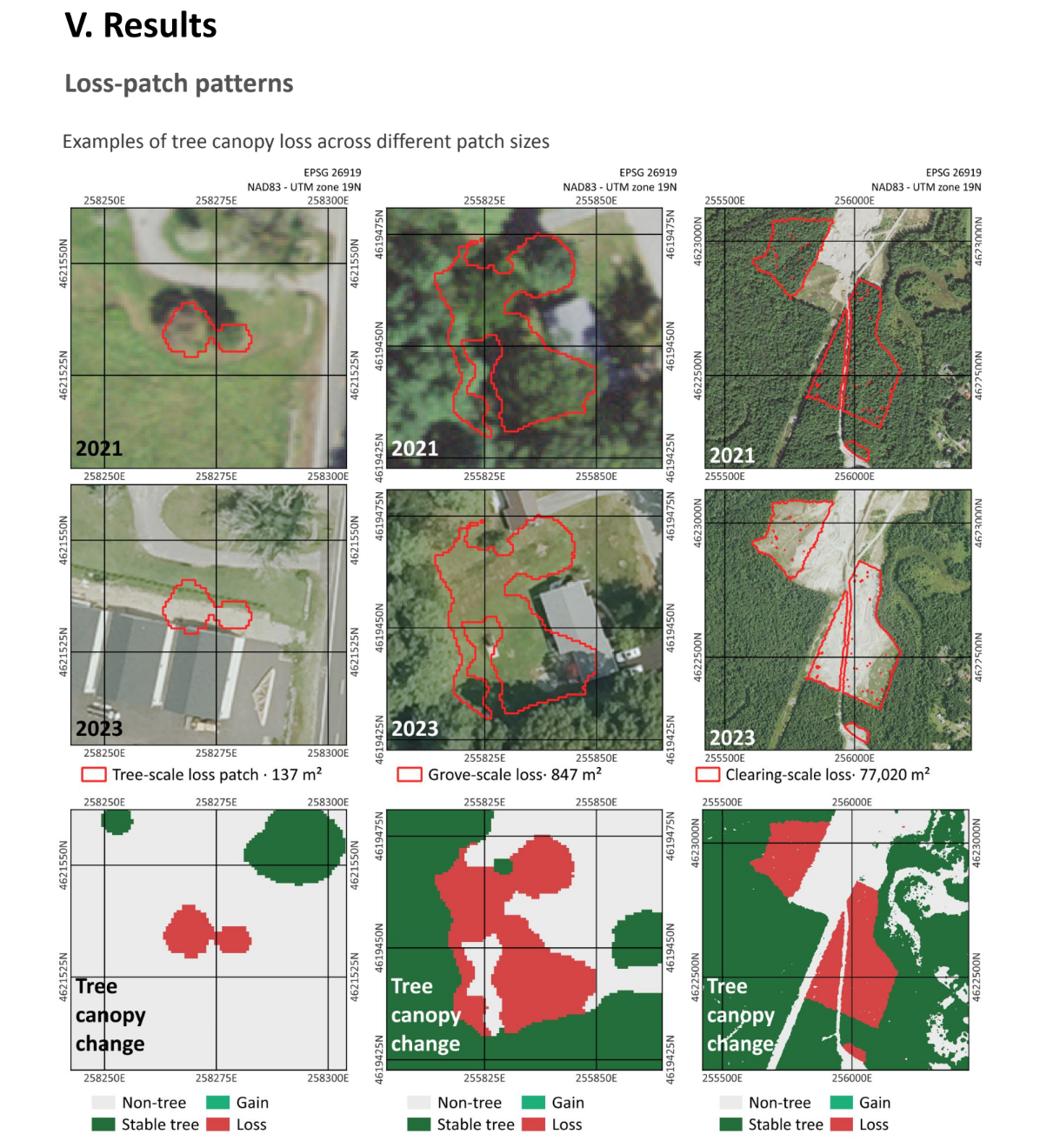
Analyzing Connecticut’s statewide tree canopy
In a pilot study for Connecticut's Department of Energy and Environmental Protection, CTrees mapped where tree canopy is increasing and decreasing across the entire state, tracking large-scale clearing and individual losses.
Plan landscape climate resilience and restoration
CTrees' works with agencies and other large-scale landholders to produce historical maps and tree canopy assessments that inform landscape restoration.

CTrees' works with agencies and other large-scale landholders to produce historical maps and tree canopy assessments that inform landscape restoration.
Track vegetation growth in corridors
For utilities and other land managers, CTrees’ tree-level analysis supports vegetation management for outages, encroachment, and fire risk.

For utilities and other land managers, CTrees’ tree-level analysis supports vegetation management for outages, encroachment, and fire risk.
Expertise in tree canopy monitoring
Expertise in tree canopy monitoring
With experience in ecology, land use planning, and remote sensing, CTrees scientists are developing innovative technology approaches to protect and restore canopies in urban and working lands.
Get In Touch
Contact us to see how our products can support your goals.
News


Stay Connected
Subscribe to our monthly newsletter and be the first to know about new data releases, research, and events.