

Tree-level data
Track tree canopies at any scale, in any ecosystem
Governments and organizations need tree-level data to plan and implement initiatives including wildfire fuel management, agroforestry, and urban canopy restoration.
Backed by innovative technology and peer-reviewed science, CTrees provides cutting-edge maps to monitor trees at fine scale in any landscape.


Governments and organizations need tree-level data to plan and implement initiatives including wildfire fuel management, agroforestry, and urban canopy restoration.
Backed by innovative technology and peer-reviewed science, CTrees provides cutting-edge maps to monitor trees at fine scale in any landscape.

Mapping trees in 100 U.S. cities
CTrees scientist Mayumi Hirye mapped tree canopy height and cover for the 100 largest urban areas across the continental United States—one of the most comprehensive studies of tree canopies in U.S. cities to date.
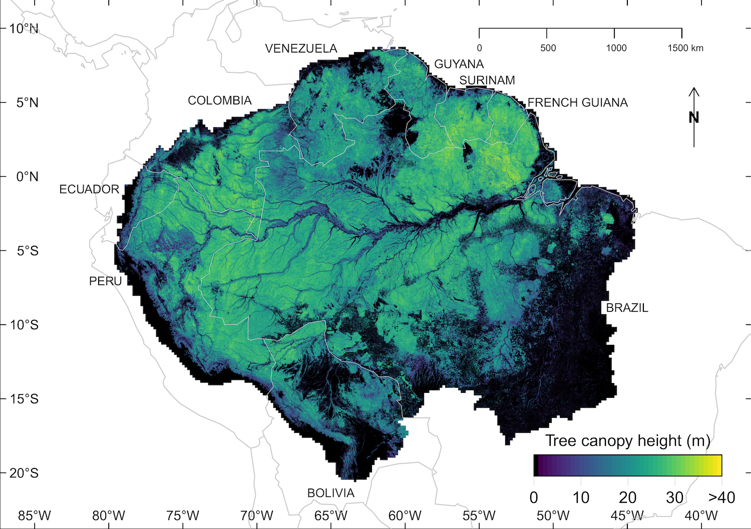
Mapping every canopy tree of the Amazon forest
In 2025, CTrees scientists released the most detailed canopy height assessment of the Amazon forest to date. The 5-meter resolution map allows for identification of every canopy tree in the world’s largest rainforest.
Map individual trees, inside and outside forests
Trees are the building blocks of every forest landscape, but detailed information about their size, location, and how they are changing is difficult and expensive to collect at scale. Without these insights, governments, organizations, and land managers struggle to fully assess risk and make informed decisions about how to best protect forests.
CTrees' tree-level data addresses this gap by providing information on individual trees at local to national scales. Data includes all trees, both inside and outside forests, across savannas, urban areas, and altered landscapes.
With detailed information on the location, crown size, height, and estimated carbon content of individual trees, users can better understand and assess changes in canopy extent and tree structure over time. Our tree-level data is designed to help plan nature-based climate solutions, guide vegetation management decisions, and support management of wildfire fuel reduction.
Tracking trees at scale
CTrees produces tree-level data at local, sub-national, and national levels. Our scientists use high-resolution imagery from airborne surveys and commercial satellite data to map individual trees and estimate their structure.
CTrees’ advanced computer vision models are trained on a large selection of sample data, collected mostly by visual interpretation of imagery. The peer-reviewed methodologies have been tested over diverse landscapes and forest types globally.
Key innovations include:
Tree cover segmentation
Each pixel is classified as part of a tree either inside or outside a forest, allowing for analysis of the area, size distribution, and spatial pattern of trees across different landscapes.
Tree instance segmentation
Each individual tree is accurately delineated, receiving a unique identification code and estimates of crown size and height. With annual monitoring, CTrees data allows users to study disturbance and recovery processes, growth patterns, and ecosystem dynamics.
Tree height estimation
CTrees uses an advanced computer vision model trained on airborne LiDAR data to predict tree canopy height at the pixel level using multispectral satellite and aerial imagery, enabling detailed tree-level characterization.
Tree dynamics
With information on trees’ location, crown size, height, and estimated carbon content, users can track tree canopy gains and losses and analyze patterns of disturbance, recovery, and growth over time.

Plan nature-based solutions at the tree level
Apply CTrees’ precise data on individual trees to design and monitor the implementation of nature-based solutions in cities, working lands, and natural forests.
Wildfire resilience
Identify optimal areas to target for wildfire fuel reduction and management.
Landscape restoration
Study forest disturbance and recovery processes across diverse landscapes, gaining insights to guide restoration efforts.
Utility vegetation management
Monitor vegetation growth and proximity to utility infrastructure to identify potential risks and support proactive vegetation management.
Urban canopy management
Access detailed data on the structural characteristics of urban forests to inform adaptation planning and boost resilience in cities.
Agroforestry
Understand how individual trees are distributed and changing in agricultural and mixed-use landscapes.
Expertise in tree-level data
Tree-level datasets
Get In Touch
Contact us to see how our products can support your goals.
Stay Connected
Subscribe to our monthly newsletter and be the first to know about new data releases, research, and events.