
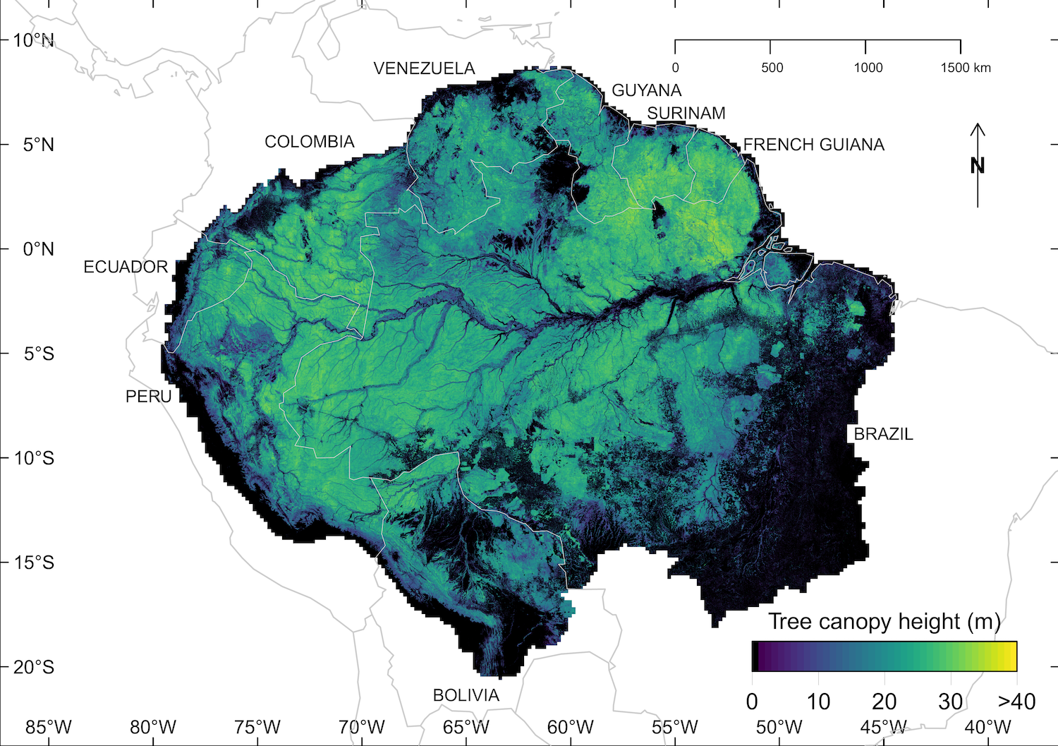
Nonprofit CTrees has released the most detailed and accurate canopy height assessment of the Amazon forest to date. Developed using advanced deep learning models, airborne LiDAR data, and satellite imagery, the 5-meter spatial resolution map allows for identification of every canopy tree in the world’s largest rainforest.
The map of the Amazon forest, representing average canopy tree height estimates from 2020 to 2024, is now openly accessible on the Amazon Web Services (AWS) cloud.
In recent decades, the Amazon forest has experienced the effects of deforestation, logging, and fire, and climate impacts like drought and extreme heat. High-resolution canopy height maps can help scientists analyze how these changes influence forest structure over time, and assess regrowth and carbon sink potential as forests recover.
“I hope that this data becomes a valuable resource for Amazonian communities, researchers, conservationists, and all those who are working to better understand and protect the Amazon—one of the most ecologically important and endangered forests in the world,” said CTrees’ research scientist Fabien Wagner, Ph.D.
Wagner is the lead author on the preprint publication behind the open dataset. The study finds an average canopy height in the Amazon of 22 meters and identifies Guiana Shield as the region with the greatest number of trees larger than 50 meters tall.
During his research, Wagner also came across what may be one of the largest trees in the Amazon forest.
To produce the map, CTrees’ researchers trained a deep learning model on high-resolution Planet NICFI images, on a monthly basis from 2020-2024, and canopy height data from the Brazilian Agricultural Research Corporation (Embrapa), National Institute for Space Research (INPE), and São Paulo City Hall.
The cutting-edge approach addresses some of the long-standing challenges associated with producing large-scale canopy height maps based on global models, including: too much time between satellite imagery, incomplete coverage, and insufficient spatial resolution.
CTrees’ model outperforms existing canopy height products, successfully estimating canopy heights up to 40-50 meters.
Better estimates of forest structure and biomass in the Amazon are essential to protecting the region’s forests, which are increasingly at risk from extensive deforestation and degradation due to road construction, logging, and fire. The Amazon forest contains more than 10% of global biodiversity, and is a critical carbon sink that helps mitigate the effects of global climate change.
“We urgently need to document the Amazon forest by all means possible in order to ensure its long-term preservation,” said Wagner. “Providing open access to our canopy tree height map is an important part of that process.”
CTrees’ canopy tree height map of the Amazon forest can be accessed via the Registry of Open Data on AWS. The data is available as cloud-optimized GEOTIFF files, and users have the option to download individual tiles or the entire dataset.
The map is the second dataset from CTrees to be made openly accessible on the Registry of Open Data on AWS, preceded by a canopy height map of California (2020). Both datasets have been made publicly available through the AWS Open Data Sponsorship Program, which aims to democratize access to high-value datasets for analysis by global researchers.
After CTrees’ initial release of the data, Samapriya Roy, Ph.D., CEO at Spatial Bytes, added the dataset to the Awesome GEE Community Catalog for further use and visualization on Google Earth Engine.
Looking ahead, CTrees researchers are exploring the potential to estimate forest regrowth with the monthly height data used to create the Amazon canopy height map. For individuals interested in exploring tree height data for measuring forest regrowth, please contact CTrees via our contact form or directly at info@ctrees.org.
###
CTrees is a Pasadena-based non-profit organization that tracks carbon in every tree and forest on the planet. Founded in 2022, CTrees delivers scientific data on forest carbon to governments and organizations seeking to reduce emissions from deforestation and forest degradation, and restore ecosystems globally.


