
This article was originally published in the 2025 IETA Greenhouse Gas Report on December 2, 2025.
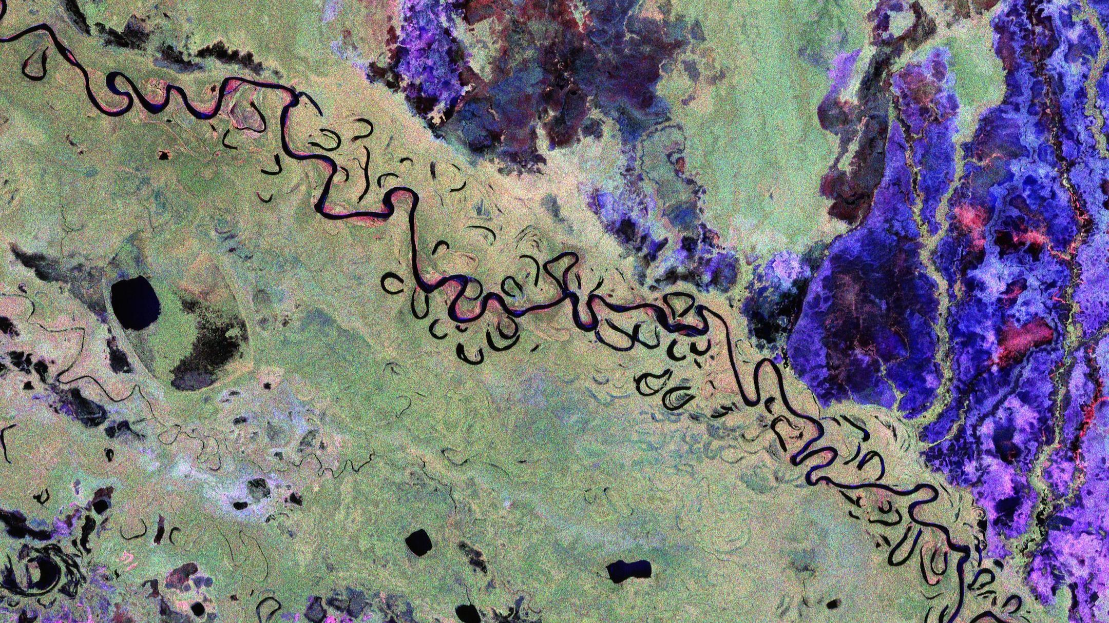
Early images from the ESA Biomass satellite mission reveal forests and landscapes in Bolivia. Photo credit: ESA.
Decarbonizing economies is no longer optional—it’s a profound moral and strategic imperative. Achieving this requires a comprehensive approach that leverages technological innovation, policy reform, and market mechanisms, while safeguarding and restoring ecosystems.
Nature-based solutions (NBS), especially trees inside and outside forests, are essential in this transition. Trees absorb over 70% of land-atmosphere carbon fluxes, reducing emissions from deforestation, land use, and wildfires, while serving as vital carbon sinks through natural recovery and restoration. Beyond climate mitigation, forests support biodiversity, protect communities from climate-related hazards, and strengthen resilience. They are fundamental to advancing both climate action and adaptation, fostering a sustainable and equitable future.
Critical role of science and technology in unlocking the potential of NBS
Realizing scalable, effective NBS requires deliberate integration of science and technology. Science defines the physical limits and pathways for emission reductions and removals, guiding targeted action. Technology transforms these insights into tangible, practical tools. This is critical for two reasons:
1. Context-Specific Solutions: NBS must be tailored to local geography, ecosystems, history, and socio-political landscapes. No one-size-fits-all approach works.
2. Dynamic Adaptability: As scientific understanding evolves, so too must NBS. Nature’s response to shifting climate conditions necessitates adaptable solutions for sustained success.
Accurate, transparent, and scalable carbon monitoring of NBS—long challenged by data gaps—is now revolutionized by earth observation (EO) and remote sensing. EO offers unparalleled spatial and temporal coverage, enabling cost-effective, precise monitoring of land use, deforestation, and biomass. This strengthens policy, enforcement, and market credibility, ensuring NBS deliver reliable MRV data essential for effective climate action.
Key technologies for NBS and GHG market are:
1. Optical Satellite Imagery: Provides high-resolution data on land cover, forest extent, deforestation, reforestation, and land-use changes. Platforms like Landsat, Sentinel-2, and commercial satellites enable detailed mapping of forest health, vegetation dynamics, and habitat classification.
2. Synthetic Aperture Radar (SAR): Penetrates clouds and is useful for monitoring forest structure, biomass, and cover changes in cloud-prone regions such as tropical rainforests. ESA’s Sentinel-1 and Biomass, and NASA and ISRO’s NISAR are key SAR sources.
3. Lidar (Light Detection and Ranging): Airborne and spaceborne lidar provide precise 3D measurements of canopy height and structure. Airborne Lidar Scanning (ALS) systems are considered the gold-standard for accurate carbon stock assessments and calibration of other sensors.
4. Hyperspectral Imagery: Capture detailed spectral signatures of vegetation leaf characteristics, moisture content, and temperature, enabling assessments of plant health, species composition, and stress detection, which are vital for targeted restoration efforts.
5. Soil Moisture and Land Surface Temperature: Often derived from microwave sensors and thermal infrared sensors, these measurements help assess ecosystem resilience, drought risk, and hydrological status related to NBS.
Monitoring deforestation and forest degradation
Land use, land-use change, and forestry (LULUCF) accounts for more than 30% of total gross GHG emissions, making accurate monitoring critical for effective climate mitigation. Key sources include deforestation, forest conversion to agriculture—which dominates tropical land use—large-scale logging, degradation from selective logging, harvests for timber and wood products, and wildfires.
Earth observation systems enable continuous tracking of forest cover loss, even in remote or unstable regions. Data from NASA’s Landsat since the 1980s, ESA’s Sentinel-2 since 2015, and SAR sensors—available routinely since the 1990s—provide global maps of land cover, forest change, and land use attribution. Near-real-time alerts from tools like NASA’s Land Change Monitoring System and CTrees’ LUCA platform support prompt action, enforcement, and transparent reporting, reducing uncertainties and boosting confidence among market actors, regulators, and the public.
Monitoring forest degradation from activities like logging, wildfires, droughts, and tree mortality remains challenging. High-resolution satellite imagery (< 3 meters resolution), mainly from commercial satellites, is essential for precise attribution. Initiatives like Norway’s NICFI program have supported free access to Planet’s visual mosaics (2020– 2024). Leveraging NICFI data, CTrees’ REDD+AI platform uses deep learning to generate the most comprehensive, reliable maps of logging, fire, and road-related degradation in tropical rainforests from 2017–2024. REDD+AI can detect logging activities monthly, providing evidence-based insights vital for reporting project performance and ensuring the integrity of carbon credits.
However, the loss of NICFI Planet data would severely undermine platforms like REDD+AI, as commercial data costs make it almost impossible to provide affordable, publicly accessible data for the community.
Mapping forest biomass carbon and changes
Beyond deforestation and degradation, Earth observation (EO) plays a crucial role in accurately quantifying forest biomass carbon stocks, regeneration, and growth—key indicators for assessing carbon sequestration and the effectiveness of management and interventions.
Integrating satellite imagery with airborne lidar and ground measurements enables the development of robust models that support precise estimates of forest carbon stocks across local, regional, and national scales. Advanced analytics, including AI and machine learning, process this diverse data to produce high-resolution, spatially explicit metrics of above-ground biomass, net removals, and growth—forming the foundation of emerging carbon accounting standards. This integration ensures that forest-based credits accurately reflect real climate benefits, fostering trust, credibility, and unlocking increased investment in carbon markets.
Historically, large-scale biomass maps were created by combining limited ground data with cloud-free optical imagery in machine learning models. While these regional and global maps effectively capture broad patterns, they often lack the accuracy required for detailed local monitoring of forest carbon. Customized, lidar-based maps—exemplified in standards like VCS Tool VT0005—remain the gold standard, but until recently, comprehensive, high-resolution EO data was limited.
Recent commitments by NASA and ESA have transformed this landscape. NASA’s GEDI (Global Ecosystem Dynamics Investigation), launched in 2018 on the International Space Station, provides global samples of forest height and vertical structure, greatly enhancing biomass mapping accuracy. ESA’s Biomass mission, launched in April 2025, is a P-band SAR specially focused on tropical forests, offering annual maps of vertical structure and biomass in the most intact, high-biomass regions.
Complementing these, the NASA-ISRO NISAR platform, launched in July 2025, leverages L-band SAR to monitor biomass loss and recovery worldwide at approximately weekly intervals. NISAR’s high-resolution, near-real-time observations enable rapid, accurate detection of deforestation, degradation, and regrowth, supporting REDD+, improved forest management, and other nature-based solutions within carbon markets and policy frameworks.
Collectively, these advanced EO systems are setting a new standard for scalable, precise, and near-real-time forest biomass monitoring—an essential foundation for credible carbon accounting and amplified climate action.
Advancing market integrity with standardized and transparent data
The success of the evolving GHG market depends on standards rooted in reliable, comparable data. Earth observation (EO) underpins these standards, enabling independent verification of emission reductions. Frameworks like VCS and ICVCM increasingly incorporate EO data, boosting credibility, lowering compliance costs, and accelerating project approval. This transparency fosters investor confidence and drives market growth.
Digital MRV systems powered by EO and remote sensing have substantially improved accuracy, scalability, and transparency in forest carbon accounting. When combined with ground validation, they support continuous, credible monitoring—vital for climate policies and market integrity. With advances in technology, like NISAR and Biomass, EO’s role in global climate mitigation will only intensify.
Overcoming challenges and driving innovation
Despite its transformative potential, EO faces hurdles. Data processing and interpretation require specialized expertise, highlighting the need for capacity building. Cloud platforms like Google Earth Engine democratize access, broadening participation. Ensuring data quality and consistency across sensors and resolutions remains critical for market confidence. Continuous innovation—integrating multispectral, hyperspectral, and SAR data—improves accuracy in complex ecosystems like wetlands and mangroves.
Collaboration among governments, research institutions, satellite providers, and NGOs is accelerating EO’s integration into market frameworks. Supported by multilateral agencies and philanthropy, these efforts are making EO technologies more accessible and reliable. However, operational sustainability is threatened, as most Earth observation data relies on publicly funded, government-operated platforms. Funding cuts and policy shifts risk undermining these vital assets, threatening the future of nature-based solutions and global carbon markets.


