
Climate policies for forests largely prioritize the planting of new trees or protection of mature forests, but one solution is often left out: naturally regenerating forests.
A study published in Nature Climate Change last month finds that secondary forests, those that have regrown after being cleared by fire, agriculture, or other disturbances, can remove carbon at higher rates than new or mature forests. Secondary forests between 20 and 40 years of age offer the highest carbon removal potential—up to eight times faster per hectare than newly planted forests.
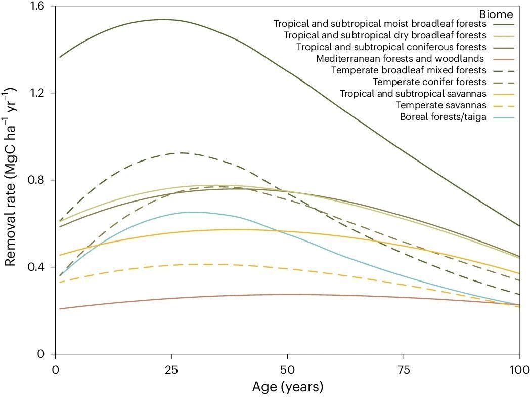
Annual carbon removal rates of secondary forests versus age in different biomes.
“Secondary forests are often overlooked in climate strategies,” said Zhihua Liu, a CTrees research scientist and co-author on the paper. “Our research shows that in many regions, even mid-aged secondary forests can offer substantially higher per-hectare carbon removal potential than newly regenerating forests.”
Liu and Sassan Saatchi, CTrees’ CEO and chief scientist, joined 11 other scientists in developing the study led by The Nature Conservancy (TNC), which calculates the carbon removal potential of secondary forests over a 100-year period for any square kilometer on Earth where forests can grow.
The findings suggest that many countries are likely underestimating the value of their secondary forests in their reporting and climate action planning.
In the tropics, for instance, only 6% of secondary forests reach 20 years of regrowth. And half of all secondary forests in the Brazilian Amazon are cleared within 8 years of establishment.
If left to grow, the 8-year old forest would remove 36% more carbon than newly growing stands by 2030, the study found.
Field plots and machine learning underpin innovative approach
Access to a trove of extensive field data combined with the latest advancements in machine learning powered the researchers’ innovative study.
Scientists from TNC, CTrees, WRI, and other partners used 109,708 field estimates, eight times more than in prior studies, to significantly expand the study’s geographic coverage—particularly in temperate and boreal regions.
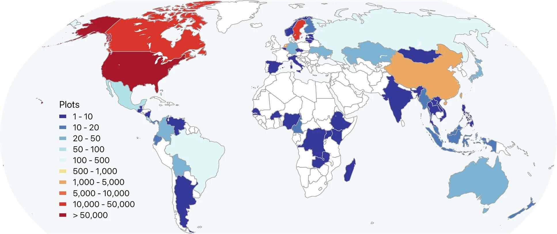
Map showing global distribution of field-plot data used to train machine learning models within the study.
Implemented in Google Earth Engine, the machine learning model incorporated 66 environmental covariates, such as precipitation, soil chemistry, and terrain, to estimate annual changes in aboveground biomass in every square kilometer of forest on Earth.
The result: a detailed and comprehensive global map that accurately estimates annual carbon removal rates in any forest biome in the world.
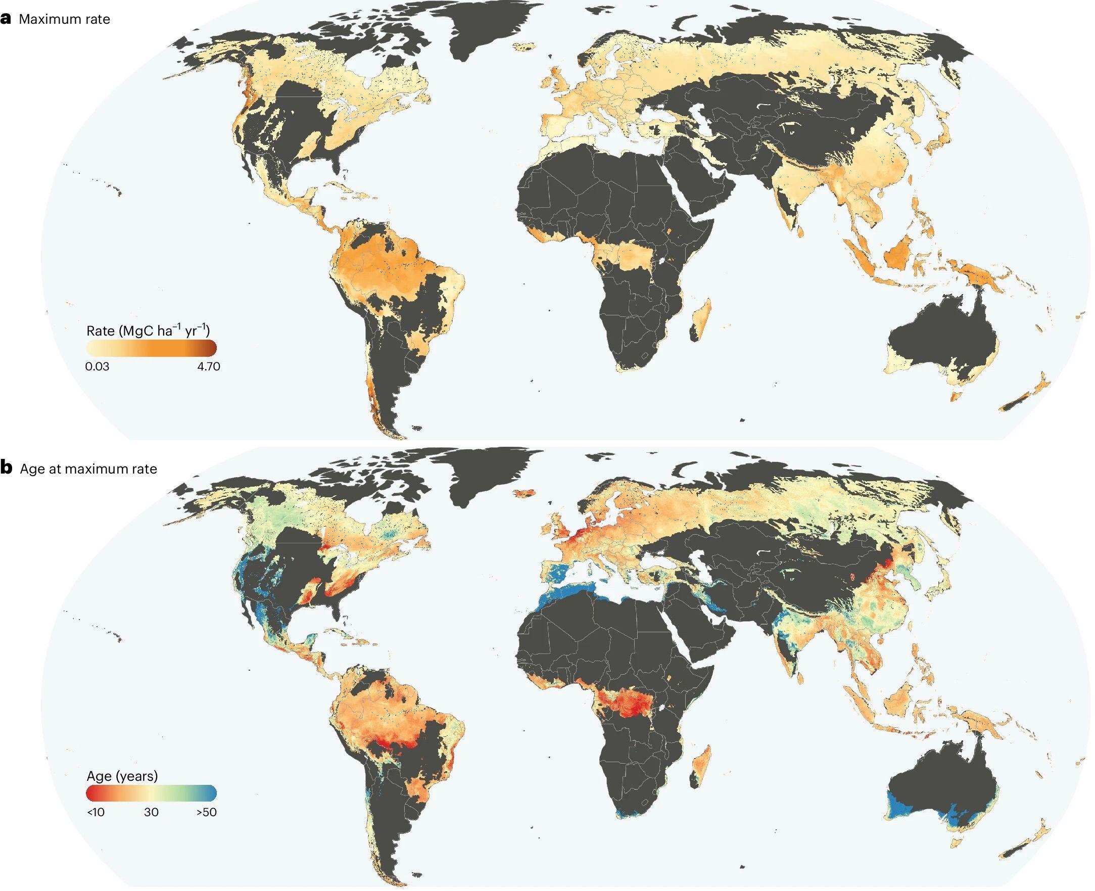
Global maps show the spatial distribution of (a) the maximum carbon removal rate achieved by secondary forests and (b) the age at which that maximum rate occurs.
The study’s geographic coverage highlighted notable differences in secondary forest regrowth across regions.
For example, tropical and subtropical rainforests and some temperate forests capture carbon fastest at younger ages–while boreal, Mediterranean, and forested areas in tropical and subtropical savanna regions reach their maximum carbon removal rates at older ages.
Prioritizing secondary forests in climate policy
Findings from the study can inform future environmental policy and planning efforts. Countries can add protection of secondary forests as an important option to their menu of natural climate solutions.
“Our research can help to reframe the role of secondary forests in climate mitigation,” said Liu. “Protecting young secondary forests should be a priority, as these forests can deliver faster and more substantial carbon benefits than initiating new regeneration.”
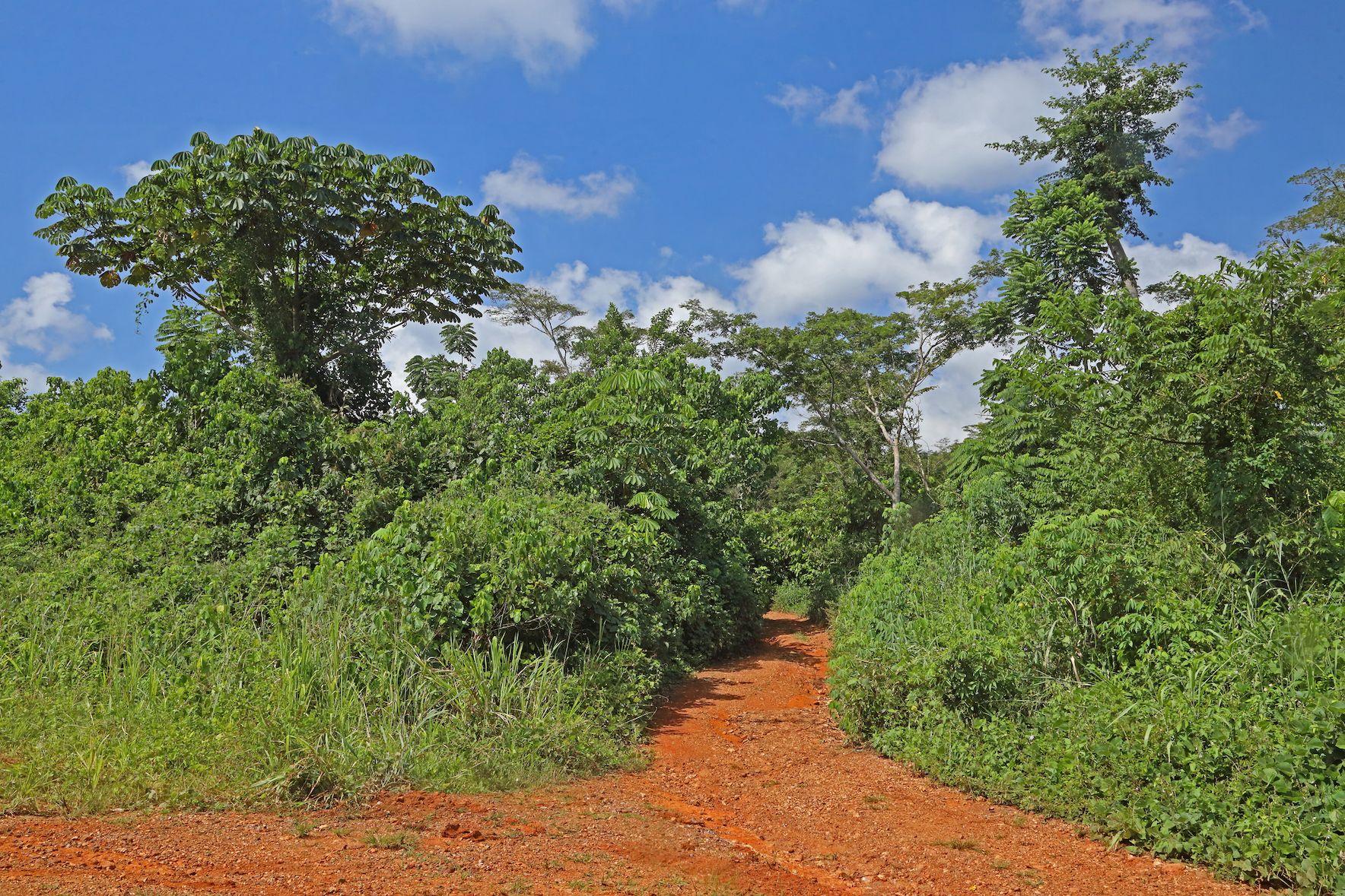
Secondary forest growth following forest clearance in the Atewa Range Forest Reserve in Ghana (Photo credit: Neil Bowman/iStock).
Recognizing the value of secondary forests and advancing policies that ensure their long-term protection is a timely and effective climate mitigation strategy to help countries achieve established Paris Agreement goals.
Looking ahead, CTrees is working with TNC to develop a global 100-meter carbon removal rate map that will integrate field data and remote sensing to support more fine-scale global monitoring efforts.


