
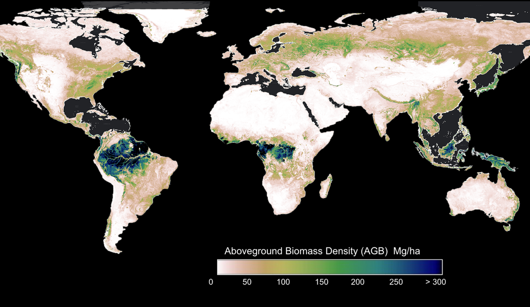
Available via Earthmover, geospatial data reveals change in trees and woody vegetation on land for 2000-2025.
Nonprofit CTrees has released aboveground biomass data for every hectare on Earth for the last 26 years. Available now as an open dataset, the maps provide scientific information on how aboveground biomass, the trees, shrubs, and woody vegetation that make up ecosystems on land, has changed over time.
The 100-meter resolution dataset is the first of its kind to be made publicly available, providing governments and organizations that manage land with vital information to establish benchmarks and measure change due to human impacts and climate change. The data cover all ecosystems on land, from dense, humid tropical forests in Indonesia, to dry chaparral in California, and sparse woodlands of southern Africa.
Based on advanced remote sensing and machine learning techniques, the data is the result of more than 20 years of science and technology developed at leading space agencies, research centers, and universities. It is backed by peer-reviewed methodologies, and insights from country experts, ground data, and national forest inventories.
“Quantifying carbon from ground, air, and space is a daunting task. Instead of using the word ‘truth,’ we need to bring technology and scientific understanding to improve estimation of biomass at large scale.” said Sassan Saatchi, CTrees’ CEO and chief scientist. “This data is designed to support the large community of policymakers, land managers, and leaders in nature-based solutions and carbon markets in designing initiatives and measuring performance.”
Why aboveground biomass data matters
Globally, billions of people rely on forests and trees for their livelihoods. Still more depend on effective forest management to ensure clean water supplies, mitigate flood risk, and regulate microclimates and the global carbon cycle. And from Western forests to the tropics, communities adjacent to forests and dry vegetation face increasing risks due to fire, as historic land management practices and shifting climate patterns make forests vulnerable to uncontrolled burning.
High-quality, spatially explicit data on aboveground biomass provides government agencies, organizations, and communities with historical insights and up-to-date information that allow for effective planning to capture the benefits of forests and trees on land, and to address mounting risks to people and ecosystems.
However, the availability of consistent, scientific data varies by jurisdiction. While many countries have established detailed forest inventories, even the most well-resourced agencies typically update their maps only once every few years, and the data may not encompass the full diversity of biomass in natural ecosystems, agriculture, and trees in urban settings. Similarly, data may be inaccessible or available only as statistics.
CTrees’ aboveground biomass data offers for the first time an independent source for anyone—from government analysts to private land managers and nonprofit experts—to compare and verify forest resources, increase the frequency of monitoring, and visualize trends as maps or charts.
Access CTrees’ 100-meter aboveground biomass time series
To meet the practical needs of users, the aboveground biomass data is available via Earthmover Marketplace, a cloud platform optimized for large-volume, geospatial data. Anyone with a free Earthmover account can access CTrees’ full AGB dataset directly from the cloud. A tutorial in Google Colab details how to access the data and conduct rapid analytics on biomass in any hectare of land, for any year, or time series, in the last two decades. The flexible, fast system allows for analysis and visualization at parcel, district, and jurisdictional levels.
In a webinar this week, Sassan Saatchi and Yan Yang, CTrees’ carbon science lead, detailed the methodology to produce the data, including integration of satellite imagery with extensive airborne LiDAR remote sensing measurements. The machine learning framework applies a wealth of ground-level aboveground biomass data collected by the CTrees team, collaborators, national forest inventory datasets, and the broader research community.
Advancing science and technology for forest monitoring
Looking ahead, CTrees is developing customized data for ecosystems that are not well captured in global products, to capture biomass dynamics in agroforestry, urban areas, plantations, and other landscapes with varied tree cover. CTrees is also developing datasets on soil carbon, mangroves and coastal wetlands, and forest productivity for release in the near future.
The aboveground biomass data add to a set of groundbreaking offerings from CTrees, including tree canopy height maps, biweekly LUCA radar alerts, and maps of tropical forest degradation attributed to activities like fire, logging, and roads. Together, the datasets offer a technology package to jurisdictions and organizations seeking to monitor forests and woody vegetation.
To learn more, explore partnership opportunities, or share feedback on the dataset, reach out via our contact form.


