
Activity Data
See deforestation, forest degradation, and forest regeneration across the tropics

Activity Data
Plan, implement, and monitor programs to reduce deforestation and restore landscapes with CTrees’ independent scientific data.
Annual deforestation
2001
2024


Deforestation in Acre, Brazil, with black showing stable forest (2000-present) and grey as non-forest
Precise monitoring of deforestation
Identify forest cover change and attribute it to deforestation.
Evaluate historical maps and statistics to pinpoint areas for intervention.
Establish accurate baselines for rates of deforestation based on maps and design-based sampling.
Lat -6.0008
Long -55.2136

|
'17|
'18
|
'19
|
'20
|
'21
|
'22
|
'23
|
Road construction for logging in Morais Almeida municipality (state of Pará, Brazil) from 2017-2023
Uncover forest degradation
Identify disturbances causing forest degradation with unparalleled accuracy and resolution.
Attribute change to specific degradation drivers: logging, fire, and road construction.
Estimate the intensity of degradation.
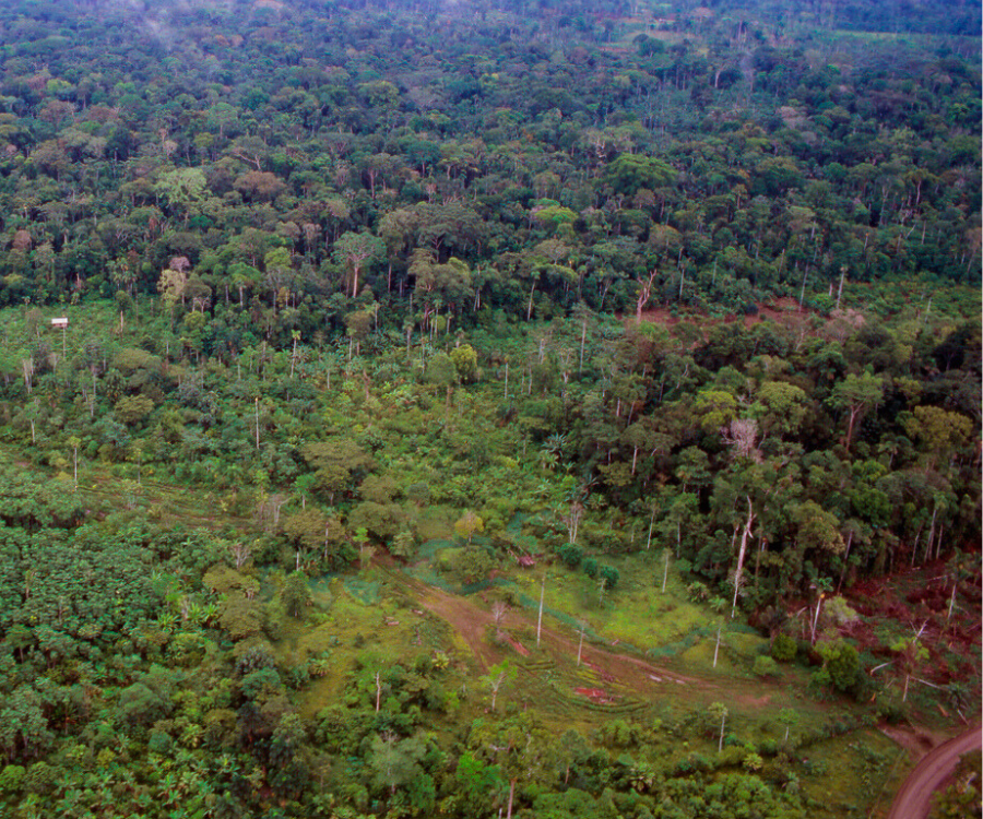
Secondary forest regrowth in a tropical rainforest in the Ecuadorian Amazon
Track forest regrowth
Detect the area and age of forest regeneration due to land abandonment, restoration, and afforestation.
Estimate forest regrowth potential in degraded or recovering forests.
Data for policy and investments
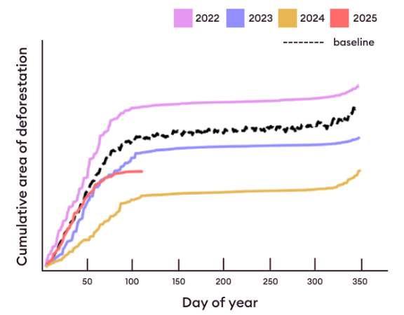
Set up customized monitoring systems for bi-weekly, monthly, and annual reporting.
Automatically estimate performance within custom areas or administrative boundaries.
Assess performance of REDD+, zero-deforestation commodity, and landscape restoration programs.
Partner with Ctrees
Contact Us


