
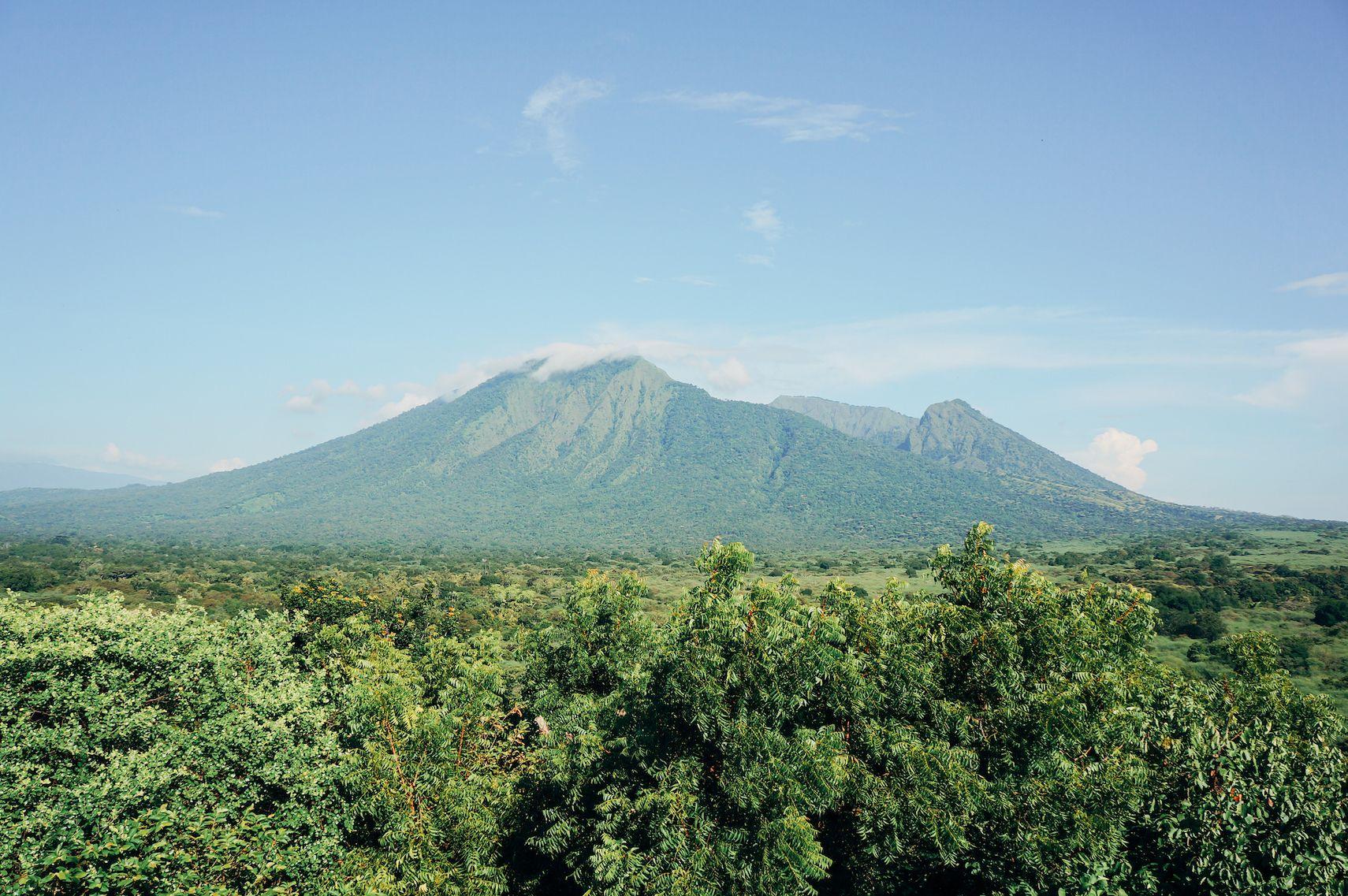
The steep slopes of Mt. Ijen in Banyuwangi Regency, Indonesia, elevate flood risk for downstream communities (photo credit: Galih Yoga/iStock).
Heavy rains in Indonesia can have deadly effects. A cyclone that hit the country’s northern islands last November brought intense downpours and landslides, resulting in more than 1,000 deaths, and the loss of hundreds of thousands of homes.
While climate change is driving more intense and sustained rainstorms, flooding is also exacerbated by deforestation, as trees are vital to absorb rain. In Sumatra, where flood damage hit hard, the expansion of crop plantations and agriculture has left only a quarter of the island’s natural forests intact.
Mapping tree loss to guide flood risk response
One local government is fighting back with risk analysis and planning interventions. Banyuwangi Regency in East Java was not in the path of the cyclone last fall, but experienced flooding and strong winds from a tropical storm in March. The government is now seeking to address the conditions that make floods worse.
As part of a regional flood mitigation initiative, the regency’s disaster management agency undertook a detailed risk analysis, including forest change data from CTrees’ Land Use Change Alerts (LUCA) platform. The agency assessed where forest had been lost, and made recommendations for ecosystem restoration and shifts in land use.
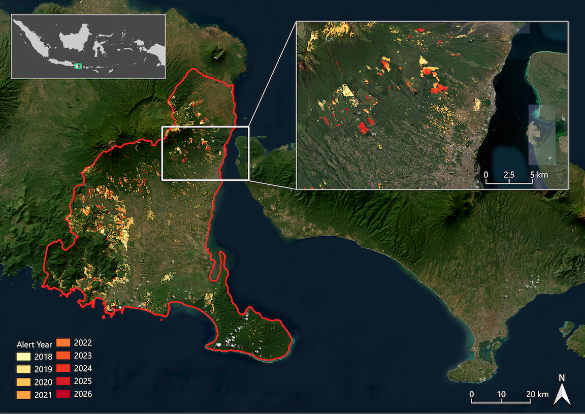
CTrees’ LUCA platform uses radar to detect forest disturbance in Indonesia’s Banyuwangi Regency from 2018 to present.
By integrating LUCA data into its spatial analysis, the agency identified deforested and degraded land located upstream of urban areas prone to flash flooding. The research allowed Banyuwangi Regency to target interventions in 11 sub-districts, including plantation planning, watershed restoration, and land use management.
In materials presented to the sub-districts, the head of Banyuwangi Regency’s Regional Disaster Management Agency (BPBD) noted the value of LUCA data in detecting recent change at a local level.
“Using LUCA data, we identified early indications of vegetation cover change in upstream forests and plantations near rivers and steep slopes. This can increase runoff, trigger sedimentation, and reduce infiltration. We also found several land-use changes that do not align with spatial planning, raising concerns for future flood risk.”
Balancing agriculture with flood mitigation
Banyuwangi Regency is also focusing on flood risk from agricultural lands. Indonesia’s national social forestry program provides local communities with legal rights to manage forest areas for income and livelihoods, typically for agriculture. While the program is important for socio-economic development, in some areas, it can contribute to decreased forest density due to monoculture or open-field agriculture.
As part of its research, agency experts overlaid LUCA results with existing social forestry datasets to identify areas to implement an intercropping agroforestry approach, called tumpang sari. Local officials are now working with farmers to plant more trees, which can improve canopy cover and water infiltration while reducing runoff and stabilizing hillside slopes.
“LUCA data plays a critical role in identifying priority upstream areas contributing to downstream flood risk,” said Viona Yashinta, an analyst with BPBD Banyuwangi. “It enables a structured analysis of land cover change in forest and plantation landscapes, providing a strong evidence base for developing mitigation strategies that integrate agricultural practices and socio-economic considerations.”
BPBD is now working with local agencies for agriculture, water resources, and the environment, as well as local governments, to consider changes in land management and plantation commodities in upstream areas.
Data to address flood risk in cities and rural areas

Heavy rain caused severe flooding in São Paulo, Brazil (photo credit: Ranimiro Lotufo Neto/iStock).
Flood risk is not limited to Indonesia. Brazil, the United Kingdom, and CTrees’ home city Los Angeles have all experienced extreme flooding in recent years. From rural to urban areas, healthy tree cover can play an important role in absorbing rain water and reducing flood risk.
By combining remote sensing datasets on tree canopies and forest change with local knowledge, government agencies can work to protect communities most at risk in a time of intensifying rainstorms.
Interested in working with CTrees to integrate LUCA data into your flood and climate risk assessments? Please reach out to learn more.


