
By Daniel Melling
Since its launch, CTrees’ Land Use Change Alerts (LUCA) system has offered users several ways to visualize and calculate forest disturbance alerts anywhere globally, by drawing a region of interest on the map interface, selecting a specific administrative area, or simply inspecting a point on the map.
Now the tool has been updated with two new features: the ability to describe and monitor a specific area, and to select lower-level administrative areas such as municipalities. The features were requested by users via our LUCA feedback form and the update reflects our commitment to continuously improving the product.
Implemented in Google Earth Engine, LUCA is the first forest monitoring tool to cover all forest biomes – tropical humid, tropical dry, temperate, and boreal. The alerts at a 0.05 hectare minimum mapping unit are based on radar data from the ESA Sentinel-1 mission, which provides reliable information approximately every two weeks under almost any weather conditions.
Access data for a specific area
LUCA previously allowed users to draw a custom region of interest on the map, which was useful for simple geometries. LUCA now also offers a way for users to specify complex geometries for specific project sites using a GeoJSON description. GeoJSON is an open standard encoding format for geographic data.
To specify a custom boundary:
- Generate a GeoJSON code using an open source GIS tool like QGIS.
- In the Region of interest (ROI) selection section, click on the “Input Geometry” button to open a dialog window. Copy and paste the GeoJSON code into the dialog window and press the Return button.
- The boundaries of the site area will appear, along with a summary chart of forest disturbance alerts from 2018 to present. The geometry specified is added to the webpage URL, which can be saved and revisited at a later date.
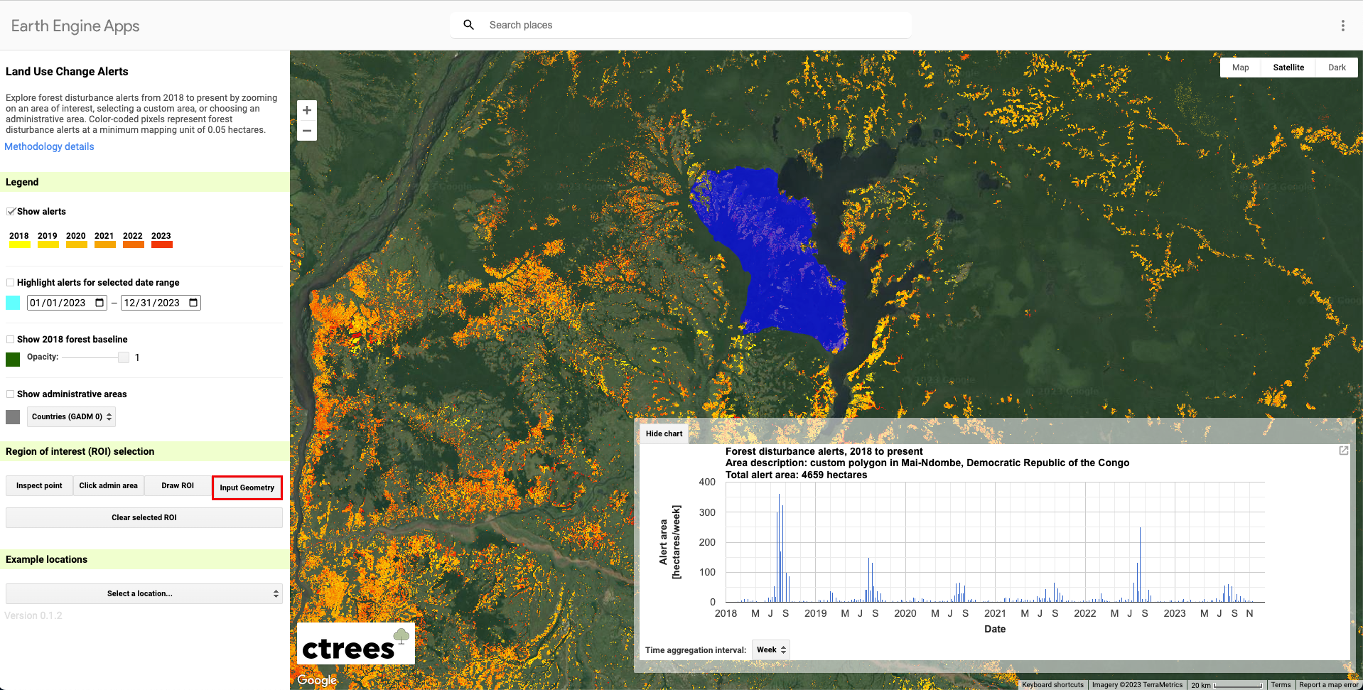
Analysis of a project area in Mai-Ndombe province in the Democratic Republic of Congo, by uploading a GeoJSON to the LUCA viewer app.
The update allows for measurement of alert data within a defined area, improving the ease of reporting for any group that is interested in alert data for project sites or other specific boundaries. With the calculator feature, users can explore trends in forest disturbance over time within the project area, via a chart showing alert data from 2018 to present.
See alerts for municipalities and other small administrative areas
LUCA now also features lower levels of administrative boundary data, where available from the Database of Global Administrative Areas (GADM). This feature is especially important for monitoring local land use activity. In Cameroon, for example, the commune is a sub-district administrative level where land use plans are designed and implemented.
To access these features:
- In the legend, under Show administrative areas, select the desired boundary level.
- In the legend, under Region of interest (ROI) selection, choose Click admin area.
- On the map, zoom in the map and click the desired admin area.
- The boundaries of the admin area will appear, along with a summary chart of forest disturbance alerts from 2018 to present.
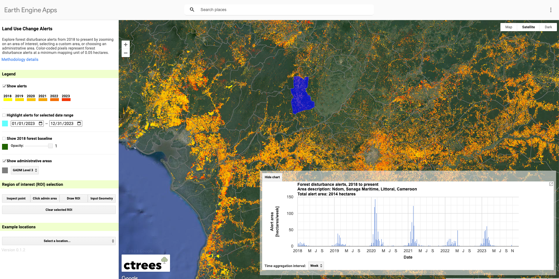
Analysis of Ndom province in Cameroon, e a GADM level 3 administrative boundary, using the LUCA viewer app
More feedback?
The CTrees science and data team would love to hear how you are using LUCA to support your work, and how we can improve the tool! Please share comments on our LUCA feedback form. For partnership inquiries, please reach out via our contact form. For reporters looking to use LUCA, please contact us at press@ctrees.org.


